


Crow Fire Hall, Jackson County, Alabama
About
Outline

Summary
| Unique Area Identifier | 521960 |
| Name | Crow Fire Hall |
| County | Jackson County |
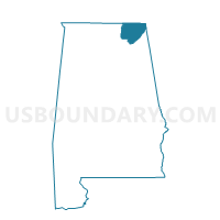
| State | Alabama |
| Area (square miles) | 24.82 |
| Land Area (square miles) | 24.81 |
| Water Area (square miles) | 0.00 |
| % of Land Area | 99.99 |
| % of Water Area | 0.01 |
| Latitude of the Internal Point | 34.85714970 |
| Longtitude of the Internal Point | -86.01788760 |
Maps


Graphs
Select a template below for downloading or customizing gragh for Crow Fire Hall, Jackson County, Alabama


Neighbors
Neighoring Voting District (by Name) Neighboring Voting District on the Map
- Flackler Fire Hall, Jackson County, AL
- Hollywood City Hall, Jackson County, AL
- Hytop Fire Hall, Jackson County, AL
- Skyline City Hall, Jackson County, AL
- Stevenson City Park, Jackson County, AL